“The satellite imagery comes to remove all the doubts which were allowed until then. “
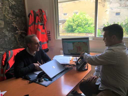
Meo-UrbanGreen, the tool for re-vegetating heat islands for smart territories, is used by local authorities to improve their planning and environmental policies. David Larée, director of technical services for the Auch Agglomeration and the city of Auch, talks about his experience with the MEO-UrbanGreen tool. An engineer with multiple hats, he has always worked in this field. Entered as a technician, he became director of technical services in February 2020 to conduct background work on the city of Auch and its agglomeration.
Do you use a legal framework to set goals and actions for environmental and planning policies?
Obviously, we have a legal framework with the various regional schemes declined in Sustainable Development Plan. The ambitious approaches to positive energy territory and the Climate Plan are gradually taking off; after a heavy design phase, we are now tackling the implementation of the action plans.
But above all, what sets the objectives and the actions in the local authorities are the political wills. We see in our elected representatives a strong desire to move towards these questions, both out of necessity and out of conviction. My duty is to anticipate, and to provide any information which supports the decision.
What are the issues you face in your environmental policies?
The first issue obviously remains climate change and its consequences in terms of water management, air quality, living environment, public health … The second is taking into account the particular topography of the city: an upper part with a high heritage value, a lower part marked by a large urban sprawl and a flood zone which covers a good third very complicated, all surrounded by nearby agricultural land. All of this has a strong impact on travel, housing, land management policies, etc. Finally, a third major issue remains the financial management of territorial changes. You have to deal with limited budgets when the stakes are enormous. Prioritization becomes fundamental, because we cannot do everything at once.
“These are products that meet the needs of the evolution of our society.”
The metropolitan area of Auch is well equipped with GIS and your territory is getting bigger, what additional contribution do you think satellite imagery brings to the territories?
The first thing I think about is that there are people who know the territory perfectly but without rationalizing what they feel. For example, for heat islands, we have already identified where it is hot, we know the virtues of a plant cover but we have never materialized this, each one composes with his own ideas and feelings. For me, the great value of satellite imagery is that it provides the data to build the objective common base that feeds the thinking of elected officials and technicians. Satellite imagery provides valuable decision support data.
In what context did you use the MEO-UrbanGreen product?
I met Thomas Ferrero, founder of MEOSS, as a colleague a few years ago, when he told me about his company and the products I immediately joined him. For now, we’ve only started on heat islands. This fits perfectly with our project to reclassify our core city spaces. As part of this project, we have about thirty spaces that will have to be reclassified. We have already done a quarter and this tool will allow us to think in a reasoned and reasonable way. In this type of arbitration, this is one of the data that should be brought to the attention of our elected officials.
Is optimizing and measuring vegetation is your main use of MEO-UrbanGreen?
In fact, we have a set of elements that will feed our decision-makers. Without going overboard with the study, they are missing data. It does not seem reasonable to talk about revegetation of our public space without knowing their temperature on the ground. For me, it is an essential tool in this decision-making process and I was convinced of its usefulness. This makes my job easier because I can support my remarks to make the information essential for prioritizing public action credible.
“It is an essential tool in the decision-making process”
Do you think satellite imagery and satellite imagery-based services represent the future for successful community planning policies?
Yes! Before, we sent technicians to the field to get information, sometimes with strong uncertainties about the measurement protocols. Now, with MEO-UrbanGreen, two months were enough to obtain this information with updated heat data according to the cloud cover. It is of incomparable power and homogeneity with what we could obtain from field surveys. The field survey can confirm data that seems out of the ordinary, but the repetitive satellite image makes it possible to obtain reliable data and monitoring over time. Previously, we were doing topographic surveys and aerial shots, you can imagine the work that this represented. And there is a satellite that does all of this for us, it’s great! This represents a remarkable time saving and rapid integration into our cartographic tools.
MEOSS offers tools for managing photovoltaic panels, monitoring land use, are these services that may interest you?
Not directly because the study of solar panels has already been done. It took us maybe two months, and I’m sure if I had ordered it from MEOSS now, I would have gotten it within 15 days. Obviously this is interesting because these are products that meet the needs of the evolution of our society.
“Satellite imagery provides valuable decision support data.”
In relation to your job which is always in the field, with the development of this type of service, do you think that your job will tend to be more in your office than in the field?
We are in the field every day, however all these services come to support us in our choices and rationalize them. This comes to re-examine the relevance of our action, and upsets a few received ideas on environmental issues.
A final word?
If I had to conclude: it is by taking a step back that we understand things better. Satellite imagery can therefore only be relevant.
To learn more about MEO-UrbanGreen, request a demo!