Home »

MEO-GREENENERGY : A NEW TOOL WHICH DETECTS EXISTING AND OPTIMIZES INSTALLATION OF NEW PHOTOVOLTAIC PANELS
CONTEXT:
With the need to reduce fossil fuel use and ongoing global warming, renewable energies are an effective solution to address these issues.
4th
primary energy source in 2017 (France)
OBJECTIVE IN FRANCE
33% of the country’s final energy consumption by 2030 will come from renewable energy.
OBJECTIVE IN EUROPE
32% of final energy consumption by 2030 will come from renewable energy (Green Deal).
To meet environmental ambitions, local authorities must respond to a global climate plan and establish renewable energies in their municipality.
MEOSS has created MEO-GreenEnergy: a tool for local authorities, managers of electrification networks and suppliers of photovoltaic panels. It detects and optimizes renewable energy establishments thanks to monitoring by satellite imagery.
Our method
Thanks to the combination of our technology and our expertise in climate issues, this tool helps identify and optimize areas for the installation of photovoltaic panels. Created as a web mapping application, MEO-GreenEnergy helps local authorities and others provide an efficient solution for smarter communities.
Its various analyzes will:
Detect existing installations
Detect renewable energy potential on ground, roofs, and on water
Optimize the installation of photovoltaic panels thanks to a range of different factors:
- Heritage (town planning constraints …)
- Agriculture (fallow detection, uncultivated plots, etc.)
- Densification (detection of buildings and parking, noise pollution, pollution zone, etc.)
- Feasibility (topography and orientation, accessibility and proximity to electrical networks, etc.)
- Satellite (sunshine and production potential of energy)
- Biodiversity (natural area of ecological interest, etc.)
Monitor the development of renewable energies with an annual data analysis
Evaluate the potential of energy production
Validate and justify investments in renewable energies by providing factual evidence for environmental policies
Help territories fulfill their objectives in terms of KWh, locations, and production

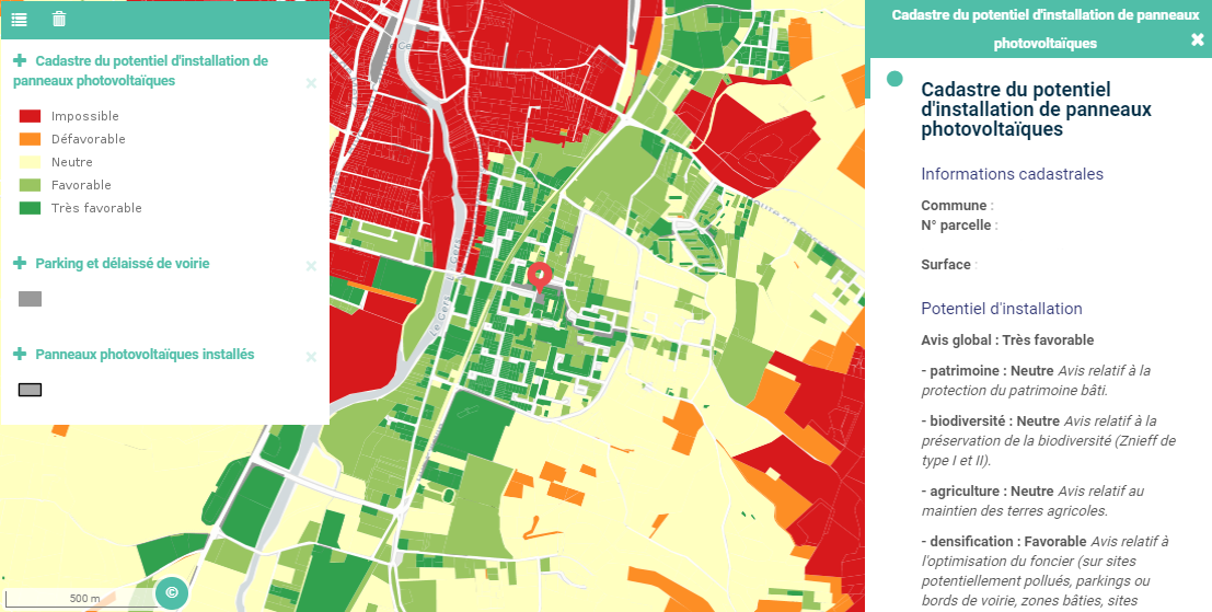
Score for potential installation of panels given to each plot
By applying a machine learning algorithm to Sentinel satellite images and local data we can automatically identify different land uses such as private house, agricultural land, scrub land.
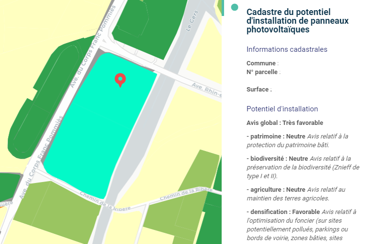
The interactive map will instantly provide the most appropriate locations for the installation of PV panels.
Each cadastral parcel receives a “score” according to the different factors and the importance given to each indicator. This score is divided into 5 classes from “very favorable” to “impossible”.
MEO-GreenEnergy ‘s objectives
Propose indicators to better evaluate and understand renewable energy establishments
Optimize the installation of photovoltaic panels
Supporting public and private actors in their renewable energy policy
Help government institution to fight climate change and fulfill their renewable energy production
Contribute to market growth for suppliers of photovoltaic panels
Evaluate associated energy production
Propose an annual follow-up allowing to observe the evolution of the environmental policies’ impact

An example showing the optimal plots selected for installation of PV panels
A climate plan study supported by the CNES (National Center for Space Studies) and validated by elected representatives, technicians was carried out to understand the climatic challenges of our territories.
This gave rise to the development of this solution labeled SCO (Space Climate Observatory).
This label brings added value and a sign of confidence for our solution because it confirms the relevance of MEO-GreenEnergy in the fight against climate change.


Created by CNES, the SCO label consists in federating at the global level, the resources of space agencies, meteorological agencies and research organizations in order to better measure and visualize the impacts of climate change and to offer decision-makers analytical tools and action.
The combination of the finesse of this tool and our expertise allows us to offer a quality service that meets your needs.
Don’t wait any longer, ask for a demo to discover the MEO-GreenEnergy app!