context:
MEOSS, in partnership with Audanis (a consultancy firm specialising in supporting economic operators in agriculture), has created MEO-Agri for agricultural cooperatives: a tool for historisation and knowledge of the territory which enables the strategic repositioning of the cooperative through a better knowledge of the territory, but also to improve the work and management of the on-site experts.
our method:
A solution developed in the form of an interactive map enabling the user to visualise:
– Land use statistics at different scales (Region, Department, canton, municipality…) at the macro level;
– The history of crop rotation on the farm or parcel at the micro level.
THE MEO-AGRI ASSETS:
- A decision-support tool based on a combination of satellite imagery and declarative data to analyse the evolution of crop rotation;
- Analysis of the cultural evolutions on the scale of a territory allowing a better strategic positioning of the cooperative;
- A tool for strategic decision-making and operational management.

You are an agricultural cooperative or a seed company? MEO-Agri is definitely made for you!
MEO-Agri, the web mapping solution that provides a precise vision of crop rotation at different scales in a territory.
By combining declarative data and satellite imagery, MEO-Agri brings a geographical dimension to the visualisation and interpretation of data to inform strategic and commercial decision-making.
Our approach:
From the declarative data (RPG in French) of a territory at the regional, departmental, cantonal and/or municipal level, we are able to analyse :
– The evolution of the total UAA ;
– The identification of the most established crops and their evolution;
– The identification of the strongest cultural evolutions and emerging cultures.
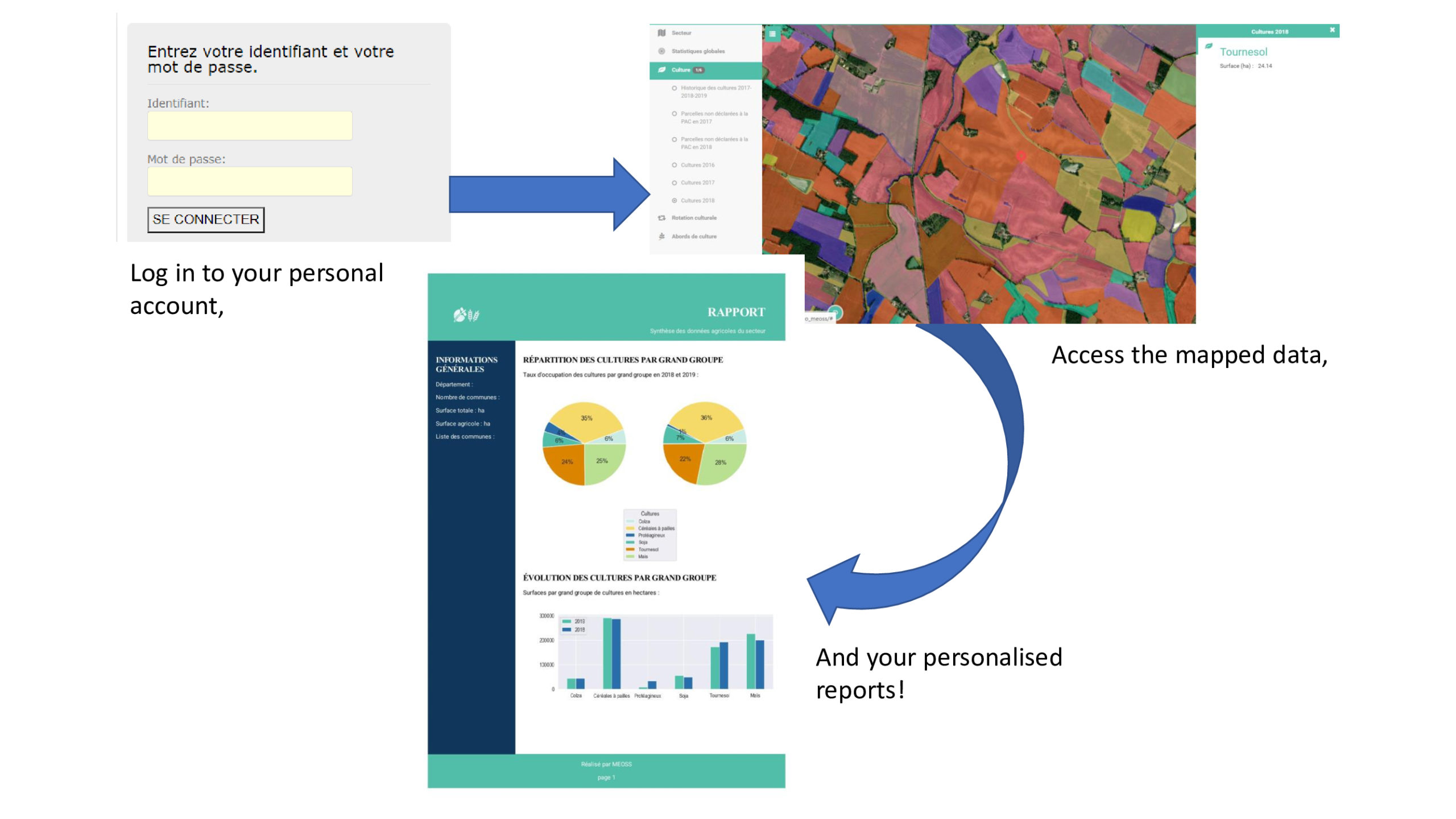
The MEO-Agri tool provides a cartographic illustration of the different cultural trends observed.
Customised statistical analysis reports are also available.

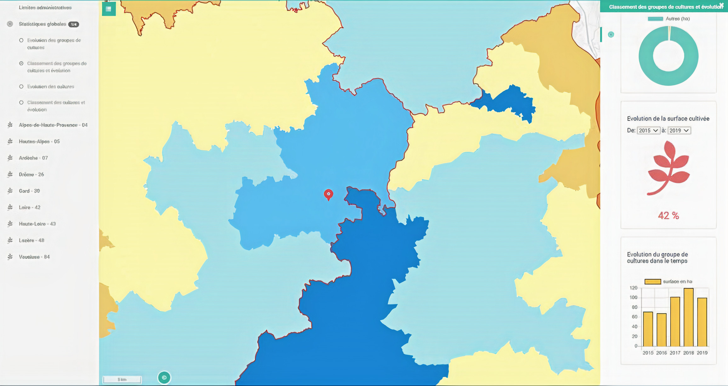
Example of crop development between 2015 and 2019 and other statistical indicators
Our added value comes from the combination of declarative data and satellite input, which provides additional information for the missing years and areas and also makes it possible to detect the environment of a parcel (hedges, roads, streams, etc.).
THe MEO-AGRI GOALS
To give an overall vision to the management in order to help the cooperative to get better positioned and steer the work of the on-site technicians;
Analyze cropping trends at a plot (and intra-plot) level to adapt positioning at local level for the sales force;
Analyze the cultural evolutions on the scale of a territory, a region, a department and/or a canton in order to capture the trends and guide the commercial strategy;
Help technicians to better manage their operations through individualised access to the MEO-Agri application;
And much more!
A decision-making tool with a dual purpose
The strategic use
The knowledge of the whole territory, and that outside of its organisation, is a major stake to support its decisions and take the best strategic orientations.
- An inventory of the territory’s crop rotation (composition of the total cultivated area, evolution of the most widely planted crops and ranking of the most important crop evolutions)
- Detailed analysis by crop using cartographic illustrations (identification of production basins and evolution rates by crop)
- Comparison of crop trends between the cooperative and the study area (show the alignment or opposition of the cooperative’s crop trends with those observed in the area)
The business use
The MEO-Agri solution facilitates the understanding of one’s commercial sector based on cartographic illustrations and allows to set specific, measurable and realistic goals:
- To know the crop rotation history of each cultivation in a client portfolio for a better preparation of meetings with farmers
- Identify the potential of cultivations not managed by the cooperative for prospecting purposes
- Customise product and service offers for each customer and prospect
- Facilitate reporting thanks to individualised summary reports

The combination of the finesse of this tool and our expertise allows us to offer a quality service that meets your needs. At MEOSS, we use our technical skills to respond in a personalized way to your needs by creating solutions always more adapted.
Don’t wait any longer, ask for a demo to discover the MEO-Agri app!
