Context
Climate change is altering the water cycle and droughts are, and will be, increasingly recurrent. The resulting significant water stresses must be anticipated and limited to avoid water use restrictions during the summer season. Despite the expertise of the territory, the data currently available are generally incomplete, heterogeneous, scattered or obsolete.
“Monitoring of hydrological processes requires repeated observation in both space and time to detect the sources and modes of transport of water and material flows in watersheds. Since the hydrological process is by nature highly heterogeneous, the more repeated the observation, the more reliable and informative it will be. Carbonneau and Piégay (2012) observe that the need to study and measure watersheds holistically naturally leads to remote sensing as a basic tool. Indeed, spatial data are the only data that allow continuous measurement at the watershed scale.” (Source : Theia website https://www.theia-land.fr/ ).
Imagery and space technologies, combined with in-situ data, have a high level of utility in providing large-scale, consistent, up-to-date, and comprehensive information.
The MEOSS MEO-WaterManagement suite of services is constantly evolving. It offers various and complementary tools to observe, assess and anticipate water-related risks and stresses.
MEO-WaterManagement: 3 services for an optimized coverage
MEO-Irrigation

MEO-WaterReserve

MEO-Drought

MEO-Irrigation
The tool for monitoring irrigated plots and their rotation
The exhaustive knowledge of withdrawals is a major challenge to plan an adapted water allocation. The immediate benefits to be gained are diverse and impact uses: adapting sowing, modulating authorized volumes or reinforcing the monitoring of the state of the site.
The agricultural sector is the first water user (70%), the exhaustive knowledge of the irrigated plots and of the withdrawals is thus a central subject for the water managers and the actors of the agricultural sector. With this in mind, MEOSS has developed its first WaterManagement service: MEO-Irrigation.

Mapping of irrigated plots between 2017 and 2020
ObjectiVEs
- Carry out an objective diagnosis of the practice of irrigation on large territories (watershed, department)
- To refine the estimates of water volumes withdrawn for irrigation (total irrigated surface, crop rotation, etc.)
- Observe trends in time and space
- Centralize irrigation data
- Facilitate decision making
PrincipLe
- Locates and distinguishes between irrigated and non-irrigated plots
- Characterizes the practice of irrigation (plot area, crop rotation, crop rotation and irrigation)
- Integrates and spatializes the declared data of water withdrawal by drilling for irrigation (BNPE)
- Offers a panel of micro indicators at the plot level and macro indicators at the watershed or administrative boundary level to facilitate analysis and decision making
- Web-based mapping application to view and compare indicators
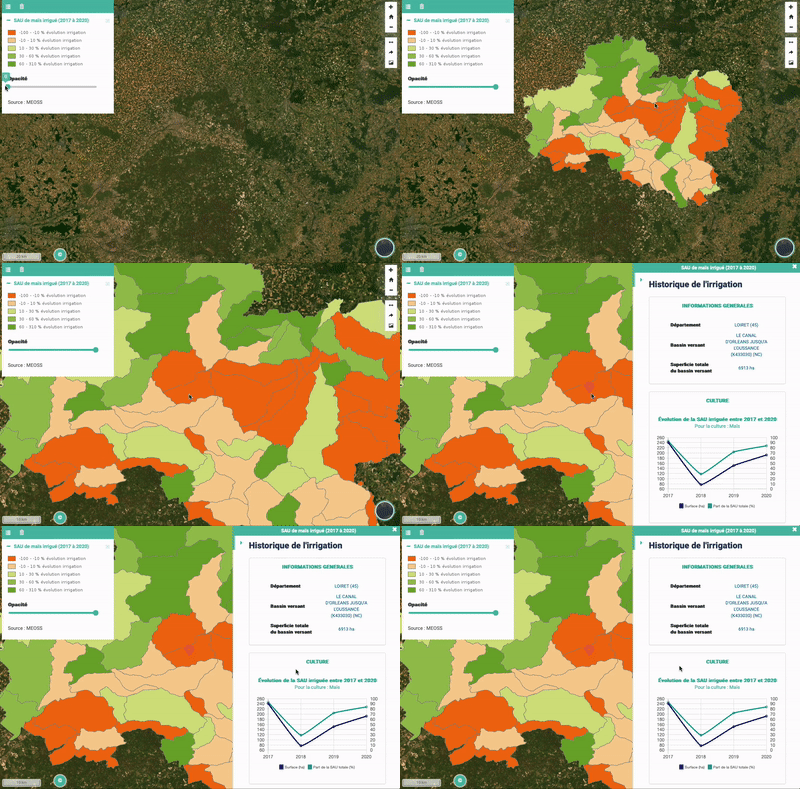
Mapping the share of irrigated corn between 2017 and 2020
Who is it for?
Water Managers
- Actors in charge of operations
- Actors responsible for policy, planning and control

Agricultural players
- Agricultural cooperatives
- Irrigation equipment salesman / installer

MEO-WaterReserve
The tool for measuring and monitoring water bodies
The water bodies are subject to climatic and human constraints that give these hydrological units a certain dynamic. The poor management of water bodies through abusive withdrawals contributes to depleting the available potential. The effect of soil erosion downstream contributes to sedimentation and the reduction of their storage capacity. Extreme climatic phenomena are responsible for strong variations in water levels, causing floods and droughts.
To implement an integrated management of water bodies and a better planning of their use, the knowledge of these dynamics must be known at the scale of the catchment areas. Regular inventory and temporal monitoring of water bodies are key.
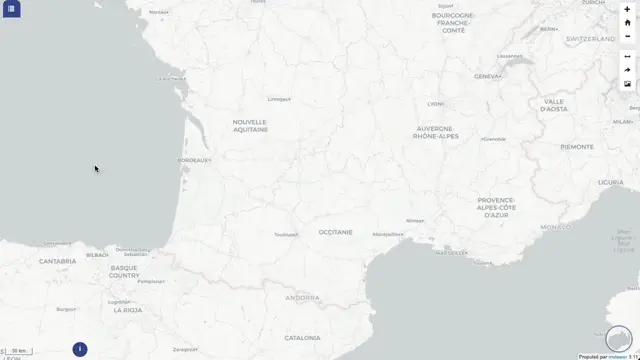
Monitoring water bodies in 2023
ObjectiVEs
- Inventory and characterize water bodies of all sizes over large territories (watershed, department)
- To refine the estimates of available water volumes
- To observe the dynamics in time and space (evolution of water bodies)
- Locate new water bodies, dry water bodies, saturated water bodies
- Set alert and critical threshold levels (water stress)
- Centralize water data
- Facilitate decision making
PrincipLe
- Mapping of water bodies and their characteristics (extent, position in relation to the hydrographic network, level of use)
- Quick visualization of the temporal dynamics of the water bodies thanks to graphs of the variation of the extent over several years
- Comparison of the maximum and/or minimum extent of water bodies with a reference year
- Mapping of water occurrence/persistence at the water body scale
- Measure and monitor water availability
- Provides a panel of micro indicators at the water body scale and macro indicators at the watershed or administrative boundary scale to facilitate analysis and decision making
- Web-based mapping application to view and compare indicators
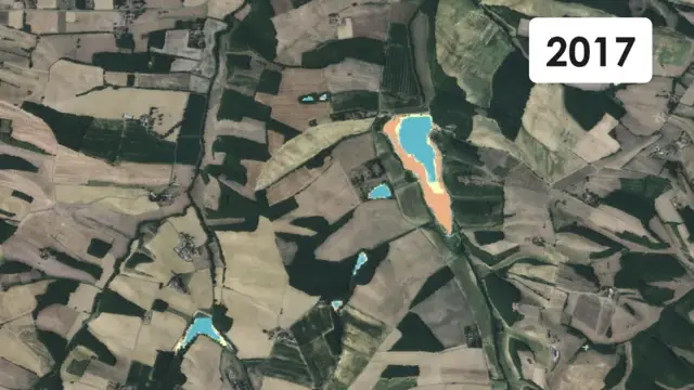
Evolution of water occurrence between 2017 and 2022
Who is it for?

Water Managers
- Actors in charge of operations
- Actors responsible for policy, planning and control

Agricultural players
- Agricultural cooperatives

MEO-Drought
The tool for monitoring plant drought and water stress
The MEO-Drought service provides cartographic monitoring of plant drought and water stress in order to identify areas with water deficits. Observe, assess and anticipate to better support agricultural players in better managing water resources.
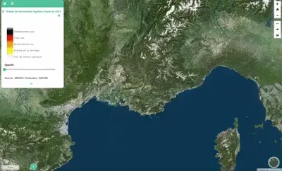
Average plant drought in 2022
ObjectiVEs
- Avoid water conflicts and control uses
- Better performance of the drought index model
- Plan irrigation and increase yields
- Adapt crop type to local water availability
PrincipLe
- Plant drought level monitoring
- Measuring drought intensity at topographic basin level
- Mapping of average monthly water index
- Monitoring water content in agricultural plots
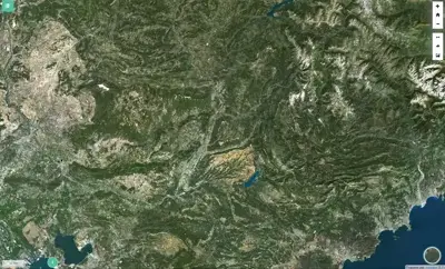
Water content in agricultural plots in 2022
Who is it for?

Public players
- Water agency
- Ministries
- Single collective management organizations

Private players
- Agricultural cooperatives
- Insurance
Thanks to new technologies, R&D and scientific partnerships, MEOSS will soon offer in its MEO-WaterManagement range:
- Drought indicators related to irrigation practices;
- Monitoring of water body volumes;
- In-season irrigation detection;
- The number of water turns for irrigation;
- To finally reach the quantification of the volumes of water withdrawn for irrigation.
