Context
The law on the energy transition for green growth (LTECV in french) strengthens the role of local authorities in their fight against climate change. At the forefront of the new system, the PCAET brings together climate-air-energy issues.
It appears necessary, in the application and monitoring of planning documents, to be able to have homogeneous, coherent, and updated data related to climate, air and energy. This should demonstrate the effectiveness of the choices made and thus to adapt them. The implementation of new, reliable, up-to-date and relevant tools hase become essential for planning issues and the management of the climate change related actions. These cools, based on satellite imagery, allow the use of local data, and regular updates thanks to its recurrency.
Don’t wait any longer, ask for a demo to discover the MEO-WaterReserve application!
What is a PCAET ?
The PCAET : Territorial Climate Air and Energy Plan (Plan Climat Air Energétique Territorial in french) is a legal obligation for local authorities of more than 20,000 inhabitants. It aims to impact climate change through concrete actions on the territory. It is cyclical (every 6 years) and is divided into 3 parts :
- Territorial diagnosis
- The territorial strategy
- Action plan and project monitoring
The strategic objectives set out and met by the tool are :
- Planning a resilient territory : anticipating local adaptation to climate change and vulnerabilities
- Secure, preserve, save and optimise water resources :
– Optimize the management of existing water bodies
– Support the creation of new water bodies for irrigation to limit their negative impacts on streams and watersheds
- Bringing the climate plan to life: steering, leading and evaluating
How to monitor the availability of water resources in a territory?
MEOSS has created MEO-WaterReserve : a tool for multiple actors in the territory, such as local authorities, water agencies, agricultural cooperatives, etc. The tool is dedicated to the diagnosis and monitoring of surface water resources. Agricultural cooperatives also play a role in helping farmers adapt to climate change. It allows the intra and interannual monitoring of water bodies, to account for surface variations according to demand and season. The tool detects and dynamically maps surface water reserves, their supply modes and their density by watershed. The derived indicators allow the analysis and evaluation of the adaptation potential to climate change thanks to the recurrence of satellite data.
What does the tool offer ?

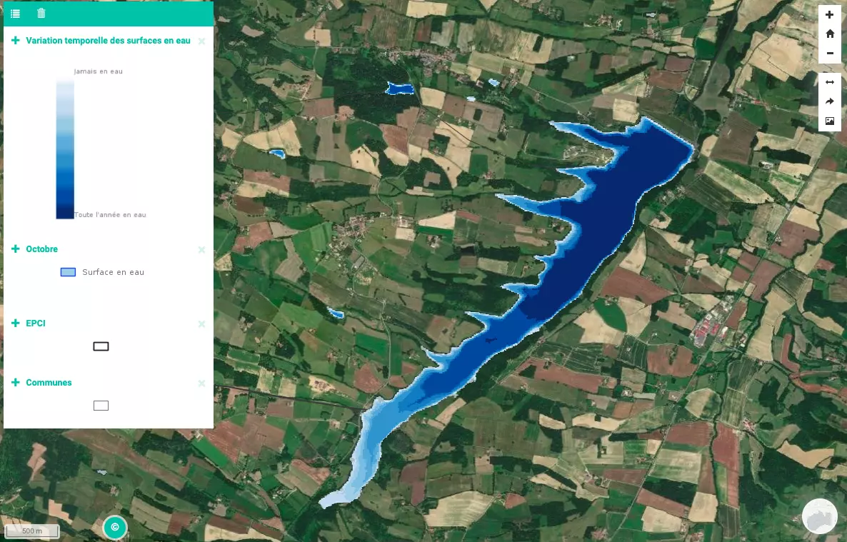
Temporal variation of water surfaces.
- Monthly monitoring of permanent water surfaces
- Annual summary of permanent water surfaces
- Temporal variation of water surfaces (max, min, current surface…)
- Methods of supplying water to surfaces
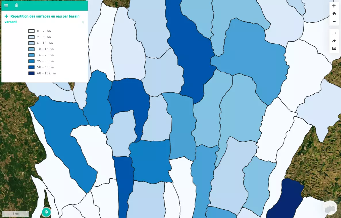
- Water Surface Density by Watershed
- Monthly monitoring of temporary water surfaces
The interactive cartography allows to give dynamically the perimeter of the permanent water surfaces according to their filling in the year, to provide information on the intra and interannual variations of the water availability on a given territory and to identify the proportion of the water bodies mobilized or mobilizable in period of tension on the resource thanks to the treatment of the current and historical data.
The pressure by watershed is evaluated through the density (number and cumulated surface of water bodies) by watershed. Finally, the modes of water body recharge are also available through the WaterReserve tool.
The statistical analyses provide an objective and accurate assessment of the adaptive capacities of a given territory to cope with climate change by highlighting the surfaces currently used and those that could be mobilized if extreme events and pressure on the resource were to increase.
THE GOALS OF MEO-WaterReserve
Propose indicators to better characterize the territories and map their potential and their sensitivities
Supporting public and private actors in their planning and adaptation policies for more resilient territories
To provide a decision support tool for monitoring water resources in order to better understand the operations in place and secure the supply of the resource
To propose a temporal follow-up through objective, robust, measurable and reliable indicators allowing to observe the evolution of the impact of environmental policies

Distribution of water surfaces by watershed.
The combination of the finesse of this tool and our expertise allows us to provide a quality service that meets your needs. At MEOSS, we use our technical skills to customize our tools to meet your needs.
