Context
The law on the energy transition for green growth (LTECV in french) strengthens the role of local authorities in their fight against climate change. At the forefront of the new system, the PCAET brings together climate-air-energy issues.
It appears necessary, in the application and monitoring of planning documents such as the PCAETs, to be able to have homogeneous, coherent, spatialized and updated data related in particular to climate, air and energy. This should demonstrate the effectiveness of the choices made and thus to adapt them . The implementation of new, reliable, up-to-date and relevant tools has become essential for planning issues and the management of the climate change related actions. These cools, based on satellite imagery, allow the use of local data and regular updates thanks to its recurrency .
Don’t wait any longer, ask for a demo to discover the MEO-AgriPractice application!
What is PCAET ?
The PCAET : Territorial Climate Air and Energy Plan (Plan Climat Air Energétique Territorial in french) is a legal obligation for local authorities of more than 20,000 inhabitants : it aims to impact cllmace change through concrete actions on the territory. It is divided into 3 phases and is to be renewed every 6 years :
- Territorial diagnosis
- Territorial strategy
- Action plan and monitoring of projects

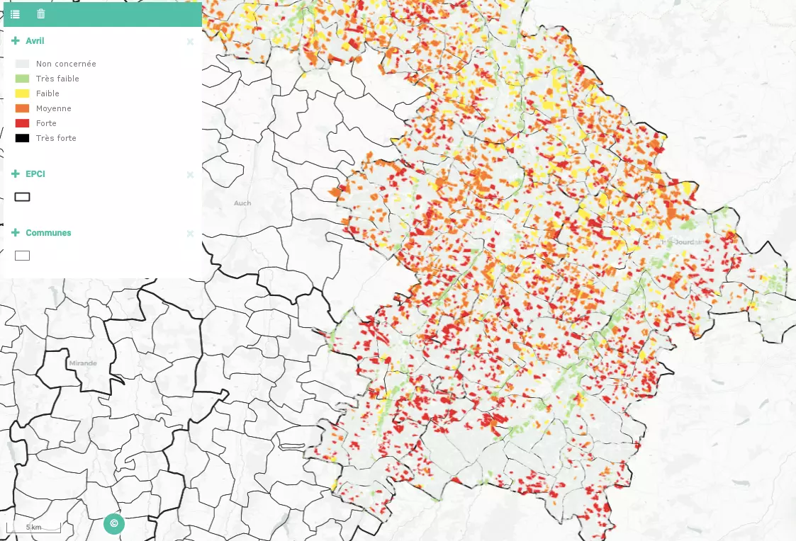
Sensitivity of agricultural plots to water erosion.
A TOOL FOR :
- Planning a resilient territory : anticipating local adaptation to climate change and vulnerabilities
- Promoting continuous conservation agriculture
- Fight against soil erosion (runoff, mudflows) in a context of soil typologies that increase this vulnerability (slopes, large-scale farming, reduction in agro-ecological infrastructures)
- Bringing the climate plan to life: steering, leading and assessing
Our method
MEOSS has created MEO-AgriPractice : a tool for local authorities, planners and land managers. The tool is dedicated to the monitoring of certain agricultural practices with regard to the issues and objectives of the PCAET. It allows the monitoring of vegetation cover, agro-ecological infrastructures and the fight against soil erosion. The tool detects and maps the vulnerability of arable land to natural risks and optimises management and adaptation actions thanks to the contribution of satellite imagery.
Its various analyses will make it possible to :

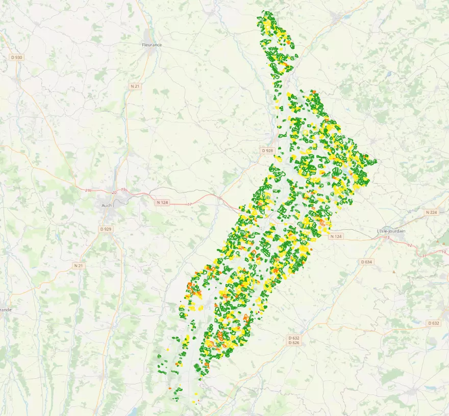
Vulnerability to catchment air erosion.
- Monitor the erosion sensitivity of agricultural plots on a monthly basis
- Assessing the pressure on the catchment area
- Characterise the hedgerows and prioritise implementation actions according to the vulnerabilities of the territory
The interactive cartography provides a dynamic view of the location of plots sensitive to erosion, and indicates favourable sites for the establishment of new hedges thanks to the combined treatment of the vulnerabilities and potentials of an area.
Each agricultural parcel is given a “value” according to the criteria of vulnerability to risk and the monthly vegetation cover rate. This value is qualified in 5 classes, from “very sensitive” to “little or not sensitive”.
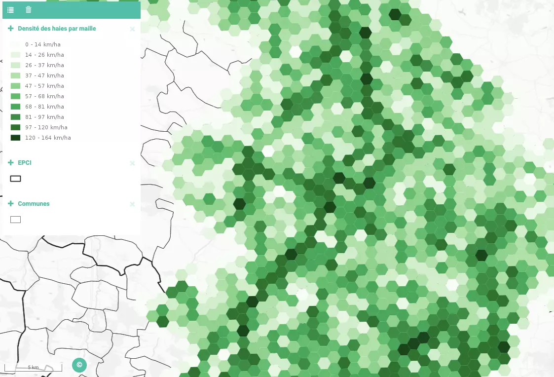
The cross-referencing of the erosion sensitivity maps with the current network of hedges and their environmental functions allows the prioritisation of sectors favourable to new plantings.
THE GOALS OF MEO-AgriPractice
Propose indicators to better characterize the territories and map their potential and sensitivity
Optimizing hedge planting
Supporting public actors in their planning and adaptation policies for more resilient territories
To provide a tool to help manage vulnerable areas and fight against erosion
Propose a temporal monitoring to observe the evolution of the impact of environmental policies

Hedge density in the Gers.
The combination of the finesse of this tool and our expertise allows us to provide a quality service that meets your needs. At MEOSS, we use our technical skills to provide a customised response to your needs by creating ever more appropriate tools.
